


Article
• August 22, 2018
This App Maps Indigenous Territories Around the World
Native Land is mapping the history of Indigenous territories and languages
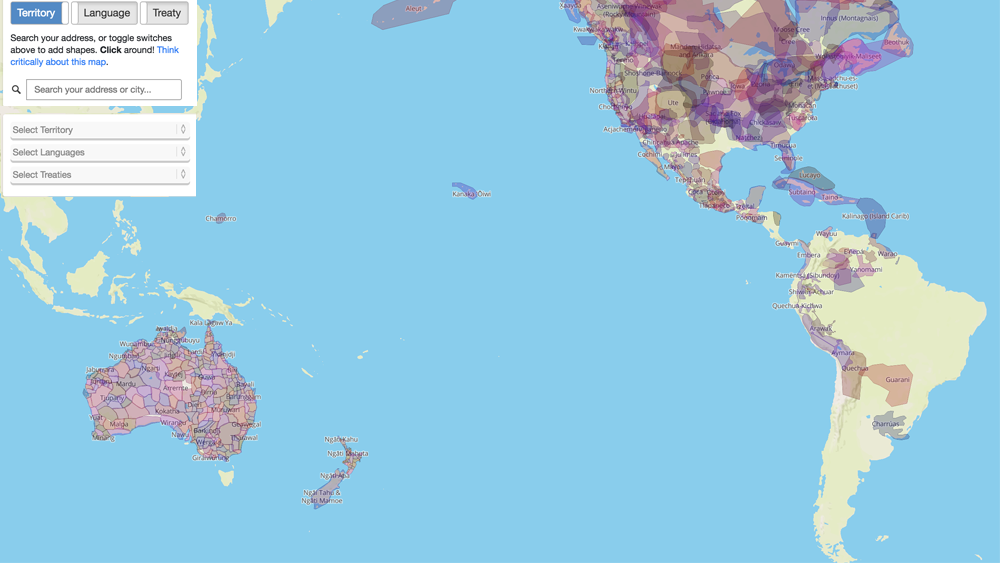
Western maps: Useful for navigating. Typically inaccurate in representing the land’s history and original people.
Native Lands hopes to remedy that—it’s a crowdsourced resource that maps former Indigenous-occupied territories throughout North America and Australia. Originally a passion project, it’s morphed into a growing record of Indigenous nations before colonization.
Search a city or address: Native Land will highlight the area and show which nation(s) previously occupied it. (e.g., Manhattan rests on Lenape territory). For deeper learning, explore where specific languages were spoken, and where multiple nations held land treaties.
Note: Native Land isn’t a professional representation of Indigenous nations. It’s a resource project, with a lot of input from Indigenous contributors, to challenge our ideas about maps, borders, and land rights.
And that’s pretty cool.
Sign up for our newsletter introducing you to the best sites, apps, and connected products.

Sign up for our newsletter introducing you to the best sites, apps, and connected products.